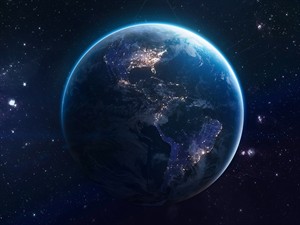
Earth is a fascinating planet full of giant continents, endless oceans, and stunning landscapes that make our world truly unique. To explore continents, oceans, and incredible landscapes, you first need the language of geography. Let’s learn the key words!
Part 1: Geography Basics
Part 1: Geography Basics
atlas — [ˈætləs] — a book that contains many maps; atlants
I opened my atlas to find where the Amazon rainforest is located.
climate — [ˈklaɪmət] — the usual weather conditions in a place over a long time; klimats
The climate in Antarctica is extremely cold, with strong winds and very low temperatures.
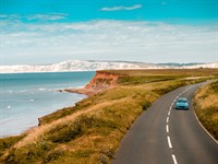
coast — [kəʊst] — the land next to the sea or ocean; piekraste, krasts
We walked along the rocky coast and watched the waves crash against the cliffs.
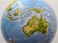
continent — [ˈkɒntɪnənt] — one of the six large land masses on the earth's surface, surrounded, or mainly surrounded, by sea and usually consisting of various countries; kontinents
Australia is the only continent that is also a single country, known for kangaroos, coral reefs, and vast deserts.
equator — [ɪˈkweɪtə] — an imaginary line around the middle of the earth that divides the earth into the northern and southern hemispheres; ekvators
Countries near the equator usually have warm weather and tropical rainforests.
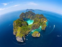
island — [ˈaɪlənd] — a piece of land completely surrounded by water; sala
After hours of sailing across the ocean, the explorers finally saw a small tropical island.
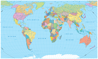
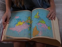
map — [mæp] — a drawing that shows countries, cities, oceans, and other places on earth; karte
Using the map, we planned our journey across Europe and marked the cities we wanted to visit.
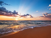
ocean — [ˈəʊʃən] — a very large body of salt water that surrounds the continents; okeāns
The Pacific Ocean is so huge that it covers more area than all the continents combined.
population — [ˌpɒpjəˈleɪʃən] — all the people who live in a particular country or region; iedzīvotāji, populācija
Tokyo has a very large population, with millions of people living and working in the city.
From icy Antarctica to tropical Asia, explore the six continents that shape our incredible planet.
Part 2: The Continents of the World
Part 2: The Continents of the World
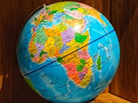
Africa — [ˈæfrɪkə] — the second largest continent, known for deserts, savannas, and rich wildlife; Āfrika
Africa has the largest number of countries (54).
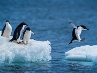
Antarctica — [ænˈtɑːktɪkə] — the coldest continent, covered with ice and without permanent inhabitants; Antarktīda
Antarctica is the coldest continent and has no permanent population.
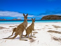
Australia — [ɒˈstreɪliə] — the smallest continent, famous for unique animals such as kangaroos and koalas; Austrālija
Australia is famous for unique animals such as kangaroos and koalas.
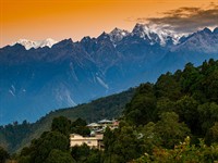
Eurasia — [jʊəˈreɪʒə] — the largest continuous landmass on Earth that combines Europe and Asia; Eirāzija
Eurasia is home to the Himalayas, the highest mountain range in the world.
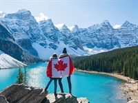
North America — [ˌnɔːθ əˈmerɪkə] — a continent that includes countries such as Canada, the United States, and Mexico; Ziemeļamerika
North America includes large countries like Canada and the United States.
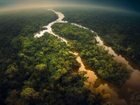
South America — [ˌsaʊθ əˈmerɪkə] — a continent known for the Amazon rainforest and the Andes mountains; Dienvidamerika
South America is home to the Amazon rainforest and the Andes mountains.
Continents are surrounded by oceans. About 71% of Earth’s surface is covered by water, while only about 29% is land.Let’s dive in and discover the powerful oceans of our planet!
Part 3: The Oceans of the World
Part 3: The Oceans of the World
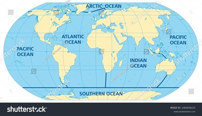
the Arctic Ocean — [ˈɑːktɪk ˈəʊʃən] — the smallest ocean, located around the North Pole; Ziemeļu Ledus okeāns
The icy waters of the Arctic Ocean stretch around the North Pole, where polar bears walk across drifting sea ice.
the Atlantic Ocean — [ətˈlæntɪk ˈəʊʃən] — the ocean between Europe, Africa, and the Americas; Atlantijas okeāns
Many ships travel across the Atlantic Ocean to carry goods between Europe, Africa, and the Americas.
the Indian Ocean — [ˈɪndiən ˈəʊʃən] — the ocean between Africa, Asia, and Australia; Indijas okeāns
Warm tropical waters of the Indian Ocean wash the coasts of Africa, Asia, and Australia.
the Pacific Ocean — [pəˈsɪfɪk ˈəʊʃən] — the largest and deepest ocean on Earth; Klusais okeāns
The Pacific Ocean, the largest and deepest ocean on Earth, is so vast that it covers more than one third of the planet.
the Southern Ocean — [ˈsʌðən ˈəʊʃən] — the ocean that surrounds Antarctica; Dienvidu okeāns
Powerful icy waves move around Antarctica in the Southern Ocean, one of the wildest on our Earth.
Pay attention: we always use the definite article “the” before the names of oceans. This is because oceans are unique geographical features. There is only one Atlantic Ocean, one Pacific Ocean, etc., so we use "the" to refer to that specific ocean. You learned about this in form 5: The Usage of the Definite Article "THE"
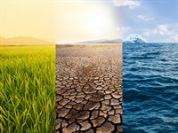
From deserts to glaciers, our planet is full of incredible landscapes. Ready to explore incredible landscapes? First, let’s revisit what you learned in form 3 and refresh your knowledge: Nature I, Nature II
Part 3: Natural Landscapes of the Continents
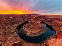
canyon — [ˈkænjən] — a deep valley with very steep sides, usually formed by a river; kanjons
The explorers stood at the edge of a huge canyon and watched the river shining far below them.
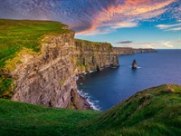
cliff — [klɪf] — a high, steep wall of rock, often next to the sea; klints
A lighthouse stood on a cliff, looking out over the powerful waves of the ocean.
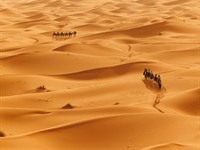
desert — [ˈdezət] — a very dry area with little rain and few plants; tuksnesis
In the hot desert, golden sand stretched to the horizon and not a single tree could be seen.
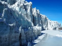
glacier — [ˈɡlæsiə] — a large, slow-moving mass of ice found in very cold regions; glečers, šļūdonis
A massive glacier slowly moved down the mountain, shining like a frozen river of ice.
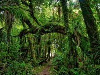
rainforest — [ˈreɪnfɒrɪst] — a thick forest in hot regions where it rains a lot; mūžamežs, tropu mežs ap Amazones upi
In the tropical rainforest, colourful birds flew above the trees while monkeys jumped between the branches.
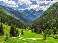
valley — [ˈvæli] — a low area of land between hills or mountains, often with a river; ieleja
Morning mist slowly lifted from the valley, revealing green fields and a winding river.
Atsauce:
Picture "Africa on globe": Sugengsan / Shutterstock.com